El Manaclar, 1800 Meter


Talort:
Bani, El Manaclar (Insel Hispanola Dom. Rep.)
Höhe Talort:
50 Meter
Höhenunterschied:
950
Meter
Start Richtungen:
Seilbahn:
Nein
Streckenflug:
Ja
Soaring:
Keine Angabe
Windenschlepp:
Nein
Walk and Fly:
Nein
Ski and Fly:
Nein
Drachen:
Keine Angabe
UL:
Keine Angabe
Google Maps:
Qualität Fluggebiet:
Qualität dieser Seite:
Statistik:
Adoption (User):
-
Zuletzt bearbeitet:
22.07.2016
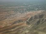
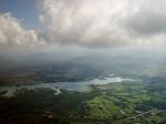
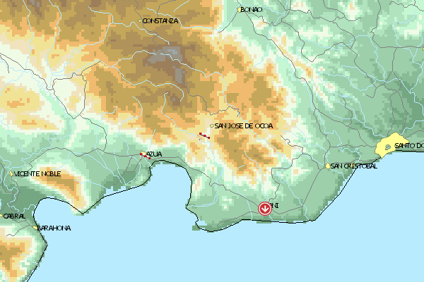
El Manaclar liegt zwischen Azua und Matua nahe der Stadt Bani, ca. 1,5h von Santo Domingo.
Allradantrieb ist erforderlich.
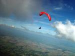
Dieser Gebirgszug ist ein Ausläufer des Zentralmassivs der bis auf 1800m ansteigt. Das Fluggebiet ist sehr anspruchsvoll! Es gibt keinen Landeplatz der im Gleitwinkel erreichbar ist, also seht unbedingt zu daß Ihr Höhe macht, wenn Ihr euch nicht in der Wildnis versenken wollt!!
Location:: The site is about 1 h 30 m SW of Santo Domingo, near a city called Bani. A four-wheel drive vehicle is required.
Launch Altitude AGL [m]:: 1000
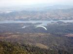
Description:: The takeoff faces S. It is located in a branch of the main Central Range. This smaller range grows up to 1800 m heading NNW as it penetrates the main Central Range.
Conditions and flight:: This is an advanced flight. There is no landing field in your glide range from takeoff, so you've got to be sure you'll go up (most of the time is pretty obvious you will).
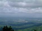
The predominating wind in the area and at that altitude is E, but the takeoff heads S. The range travels N and that's the main XC route. To the W side of the range there is a wide valley that runs parallel to it. On the other side, to the E, there is nothing but bigger mountains ending in the steepest valleys I've ever seen.
So the easiest XC flight is when the meteo wind is weak enough to let the anabatic flow set in at the takeoff height.
Maximum XC distance registered:: 33 km


 Fluggebiet
 Flugschule
 Aktuelle Position