Azua, 350 Meter


Talort:
Provinz Azua
Höhe Talort:
79 Meter
Höhenunterschied:
11
Meter
Start Richtungen:
Seilbahn:
Nein
Streckenflug:
Ja
Soaring:
Keine Angabe
Windenschlepp:
Nein
Walk and Fly:
Nein
Ski and Fly:
Nein
Drachen:
Keine Angabe
UL:
Keine Angabe
Google Maps:
Qualität Fluggebiet:
Qualität dieser Seite:
Statistik:
Adoption (User):
-
Zuletzt bearbeitet:
22.07.2016
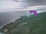
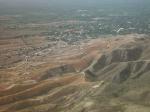
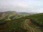
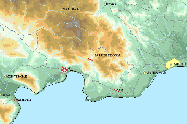
Insel Hispanola Dom. Rep./Haiti: Westlich entlang der Südküste ca. 1,5h von Santo Domingo entfernt liegt Azua. Für die Anfahrt braucht man einen Allrad-tauglichen Geländewagen. Hier gibt es inmitten der kleinen Hügelkette deren höchster Punkt bei etwa 350m liegt einen Startplatz auf 90m Höhe. Man kann von hier über die Halbwüste auf die 5km entfernte Küste im Süden schauen.
Location:: Azua is a town located about 1 h 20 m W from Santo Domingo, in the South Coast. A four-wheel drive vehicle is required, otherwise you have a 15 minutes hike up (not that hard).
Launch Altitude AGL [m]:: 90
Description:: The takeoff is located in a small range which highest point is less than 350 m AGL. This range runs E, parallel to the first big ranges of the Central Range which is about 2 km N. The takeoff faces the sea (Bahía de Ocoa), about 5 km S. Azua, as most of the rest of the South West, a semi-desert terrain.
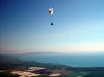
Conditions and flight:: It's an amazing flying site considering the takeoff altitude.
Pilots often takeoff early in the morning, about 10, to soar with the incoming sea breeze. A little later you can start feeling thermal activity that gets to a peak about 12:30 PM.
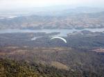
Thermals may be disordered, but if you are patient and get more than 800 m AGL then you can head N for the bigger stuff. If you succeed in reaching the big mountains behind the takeoff area, then the normal route would be NW along the Central Range, exploiting the altitude wind blowing E. XC potential is remarkable as the Central Range goes depp into Haiti, for more than a 150 km.
Maximum XC distance registered:: 60 km


 Fluggebiet
 Flugschule
 Aktuelle Position