Fuyang, 450 Meter
|
|
| Talort: |
25km SW of Fuyang, 50 Meter |
| Höhenunterschied: |
400
Meter |
| Streckenflug: |
Ja |
| Seilbahn: |
Nein |
| Windenschlepp: |
Nein |
| Walk and Fly: |
Nein |
| GPS Tal: |
29° 52' 38.92'' N,119° 54' 35.92'' O |
| GPS Berg: |
29° 52' 19.74'' N,119° 55' 16.73'' O |
|
The site is 60km SW of Hangzhou which is 170km SW of Shanghai
maps.google.de/maps?f=d&source=s_d&saddr=Railway+station,+Hangzhou,+Zhejiang,+China&daddr=%E5%B8%B8%E5%AE%89%E9%95%87,+%E5%AF%8C%E9%98%B3%E5%B8%82,+Hangzhou,+Zhejiang,+China&geocode=%3BFcX5xwEdV4glBykHYcm3XJFLNDHJWBvnvl6pHQ&hl=de&mra=pe&mrcr=0&sll=30.231781,120.163994&sspn=0.134076,0.148659&ie=UTF8&ll=30.245573,120.185966&spn=0.067029,0.074329&z=13
|
|
Flug
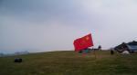
Huge takeoff with nice green
facing NW
Catch the termals out of the valley
At the weekend several taxi waiting to bring you back for 10RMB
Schwierigkeit
don´t land in the rice fields
Besonderheiten und Webcam
Wissenswertes
| Unterkunft: |
Near the takeoff is little chinese Hotel
Only Chinese spoken 13738119797 |
| Anfahrt: |
From Shanghai take the train to Hangzhou.
You can call the Hotel to send you a Shuttle to the take off (260RMB) |
|

|