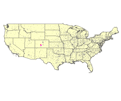
Villa Grove, 3180 Meter
|
|
| Talort: |
Villa Grove, 2640 Meter |
| Höhenunterschied: |
320
Meter |
| Streckenflug: |
Ja |
| Seilbahn: |
Nein |
| Windenschlepp: |
Nein |
| Walk and Fly: |
Nein |
| GPS Tal: |
38° 14' 55'' N,105° 56' 55'' W |
|
|
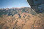
Has anyone ever seen such a landing zone? Over dozens miles the San Luis Valley stretches all the way down to New Mexico... This makes coming down like a childrens game.
|
|
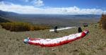
Flug
Yet also in the air, one has there fun and there is also a large cross country flight potential in the zone named also Little Owens Valley. One has here in 2000 ft a visible inversion, that can be broken through with some patience, and cheerfully soar further up.
Schwierigkeit
Weather: this tends to be a strong wind site, suitable mostly for hang gliders rather than PG's. July thru Aug. tends to have a monsoon weather pattern which produces huge cumulonimbus clouds. Flying in the presence of these clouds can be VERY hazardous. For PG's to fly safely, the forecast winds should be 10 mph or less. The winds on launch/ top can be 2X the landing zone.
XC to the south is limited by the 'Great Sand Dunes' Nat.Park. Do NOT land there!! (About 50km south from launch)
Wissenswertes
| Unterkunft: |
Very few (decent) options in Villa Grove; but a large variety of accomodations/ shops can be found in Salida (about 30mins to the North).
A small store/ cafe in Villa Grove. |
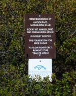
| Anfahrt: |
The road requires 4WD with high clearance !!!
Im Villa Grove turn east direction Hayden Pass; you'll pass the 'official' LZ (where all the wind streamers are). Continue; then take the first option to the left - from here on it gets really bad... |