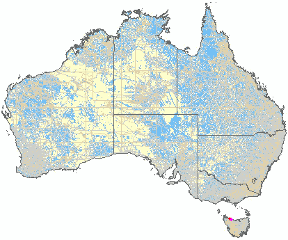
Circular Head, 200 Meter
|
|
| Talort: |
Wynyard, 21 Meter |
| Höhenunterschied: |
161
Meter |
| Streckenflug: |
Ja |
| Seilbahn: |
Nein |
| Windenschlepp: |
Nein |
| Walk and Fly: |
Nein |
|
Table Cape Round Hill 200 Hm
An excellent coastal site with many different wind directions. Here Paraglider and Hang Glider will probably feel simmilar. The starting places above are easily accessible, only there is not so much space for Hang Gliders. Flight times up to 4.5 hours and heights up to 600m are no rarity! The beach gives loads of space to land.
Sorry, Text von einem CH : "Vaudee" Andy von Dach, er war wohl 1x kurz da, es gibt 1 SP für Normalstarts, der 2. ist für Acrokünster (ab dem PP) und dann ist fertig mit Startplätzen hier. Nicht auszudenken wenn man hier wie auch immer, vor dem SP absäuft, darum neues Bild.
.
|
|
Besonderheiten und Webcam
[b]Meldepflicht[/b]
Immediately after the flight or before flying you must inform Dave at [url]dave@thga.net.[/url] This is important due to the agreement between the council and flyers to note all flyers and the flight details.
. |
Walk and Fly
| Ausgangspunkt: |
|
| Wegbeschreibung: |
|
| Sonstiges: |
.
Einer der schönsten National-Parks in Tasmanien heisst :
[b]Cradle Mountain - Lake St. Clair[/b]
Wer die Natur von Tasmanien richtig sehen will, lässt sich die 5-tägige Moorlandschafts-Wanderung vom Lake Dove bis runter ans Ende des Lake St. Clair nicht entgehen. Aber auch schon der 1-stündige Rundgang um den Lake Dove ist ein unvergessliches Erlebnis ♡
Darum das Bild vom See mit dem Kippen-Berg dahinter.
. |
|

|
Startplätze |
| Startplatz: |
Round Hill |
| GPS-Koordinaten: |
40° 56' 55.6'' S,145° 43' 52.7'' O |
| Startrichtung: |
W |
| Schwierigkeit: |
schwer
|
| Höhe über NN: |
182 |
.
Klippenstartplatz ab leicht geneigter Wiese
Keine Windspione, meist sehr viel Wind,
dazu wird der Wind von links noch kanalisiert,
also kniffglige Situation !
● G-Koordinate : -40.948768 / 145.731308
...oder direkt vor dem TABLE CAPE LOOKOUT Parkplatz ?
.
|
|
|
|
|
|
Landeplätze |
| Landeplatz: |
Farm House SW-Seite |
| GPS-Koordinaten: |
40° 57' 38.2'' S,145° 43' 26'' O |
| Schwierigkeit: |
leicht
|
| Höhe über NN: |
21 |
.
Landeplatz-Seite je nach Windrichtung auf
den grossen baumfreien Farmwiesen,
auf der Süd- oder Nordseite des Round Hills.
● G-Koordinate :
.
|
|
|
|
|
|
Umgebungskarte

Interaktive Karte
| Orte in der Nähe
Wynyard (0 km)
Flowerdale (3 km)
Moorleah (7 km)
Lower Mount Hicks (8 km)
Allen Siding (8 km)
Boat Harbour (8 km)
Oldina (10 km)
Somerset (11 km)
Sisters Creek (11 km)
Oldina (11 km)
Oldin (11 km)
Kellatier (12 km)
Myalla (13 km)
Lapoinya (13 km)
Elliott (14 km)
|
Fluggebiete in der Nähe (Radius: 50 km) |
|
Australien / Ozeanien » Australien » Tasmania
Fossil Bluff, 100 Meter
Adopted by: [Vaudee]
| Entfernung: | 6 km
|
|
Höhenuntersch.:
|
79
Meter
|
| Ort: | Wynyard
|
| Streckenflug: | Ja
|
| Startplatz: |
mittel
|
| Landeplatz: |
mittel
|
Fossil Bluff is a 100 m high hills aligned NE heading East towards Table cape. The start place is not reached easily and offers a steep ascent....
|
|
|
Australien / Ozeanien » Australien » Tasmania
Don Heads, 75 Meter
Adopted by: [Vaudee]
| Entfernung: | 6 km
|
|
Höhenuntersch.:
|
54
Meter
|
| Ort: | Wynyard
|
| Streckenflug: | Ja
|
| Startplatz: |
leicht
|
| Landeplatz: |
leicht
|
Very easily to fly and suited for great landings. As the start zone is very flat, you must develop your flight characteristics efficiently, so...
|
|
|
Australien / Ozeanien » Australien » Tasmania
Rocky Cape, 175 Meter
Adopted by: [Vaudee]
| Entfernung: | 21 km
|
|
Höhenuntersch.:
|
171
Meter
|
| Ort: | Rocky Cape
|
| Streckenflug: | Ja
|
| Startplatz: |
schwer
|
| Landeplatz: |
schwer
|
Rocky Cape
A lovely coastal flight zone with a fantastic view. The site is better suited for the Paraglider than the Hang Glider.
...
|
|
|
|
Flugschulen in der Nähe (Radius: 50 km) |
|
Australien / Ozeanien » Australien » Tasmania
Tasmanian Hang Gliding & Paragliding associations
Tasmanian Hang Gliding & Paragliding associations
Anthony Mountain
President
www.thpa.net
Entfernung: 6 km
Die Tasmanian Hang Gliding & Paragliding Associations gibt gerne über Flugseiten oder Flugschulen in Tasmanien Auskunft.
|
|
|
|
|
|  |
|