Mount Elliot, 930 Meter
|
|
| Talort: |
Corryong, 316 Meter |
| Höhenunterschied: |
614
Meter |
| Streckenflug: |
Ja |
| Seilbahn: |
Nein |
| Windenschlepp: |
Nein |
| Walk and Fly: |
Ja |
|
Mount Elliot 614 Hm
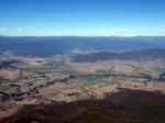
This mountain in the inner country enables spectacular flights over the beautiful valley, above all in the off-season. Heights up to 3,000m demonstrate the crazy flight conditions and offer a spectacular view on the ten highest peaks in Australia.
.
|
|
Flug
It is started north of the tower outwards. You can land almost anywhere; the only interference is the Power lines. Make sure you treat the land owners with due respect.
Walk and Fly
| Ausgangspunkt: |
|
| Wegbeschreibung: |
|
| Sonstiges: |
|
Wissenswertes
| Unterkunft: |
There are two camp sites available around Corryong both of which also provide cabins. |
| Anfahrt: |
Near Corryong, 320km North of Melbourne. The starting place is easy to see from the town of Corryong. Drive along the street out of town in the direction of Kancobarn on the far removed side of the mountain. Take the gate at the Fishers Track and follow it all the way up to the tower. While you may be able to make it to the top with a normal car, four wheel drive is recommended.
. |
| Sonstiges: |
. |
|

|
Startplätze |
| Startplatz: |
Mount Elliot |
| GPS-Koordinaten: |
36° 11' 9.1'' S,147° 58' 31.9'' O |
| Startrichtung: |
W, NW |
| Schwierigkeit: |
mittel
|
| Höhe über NN: |
930 |
Schöner Wiesenstartplatz am Waldrand ---> Schatten 😉
Windspione, Platz für 10 GS
.
|
|
|
|
|
|
Landeplätze |
| Landeplatz: |
Corryong - Mildren Street |
| GPS-Koordinaten: |
36° 11' 24.3'' S,147° 54' 38.7'' O |
| Schwierigkeit: |
leicht
|
| Höhe über NN: |
316 |
Flache grosse Wildwiese vor dem Golfplatz,
dieser LP ist in der Nähe des Hotels,
normal wird auf dem AIRFIELD gelandet 😎
.
|
|
|
|
|
|
Umgebungskarte
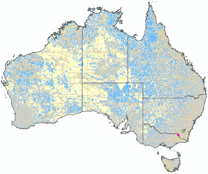
Interaktive Karte
| Orte in der Nähe
Corryong (0 km)
Thougla (7 km)
Cudgewa North (11 km)
North Cudgewa (11 km)
Towong (12 km)
Cudgewa (12 km)
Towong Upper (14 km)
Nariel Upper (14 km)
Upper Thougla (15 km)
Biggara (15 km)
Wabba (16 km)
Tintaldra (17 km)
Khancoban (18 km)
Burrowa, Mount (21 km)
Berringama (21 km)
|
Fluggebiete in der Nähe (Radius: 50 km) |
|
Australien / Ozeanien » Australien » Victoria
Mount Mittamatite, 990 Meter

| Entfernung: | 8 km
|
|
Höhenuntersch.:
|
680
Meter
|
| Ort: | Corryong
|
| Streckenflug: | Ja
|
| Startplatz: |
mittel
|
| Landeplatz: |
mittel
|
Mount Mitta Mitta
A high rocky mountain with good thermal ratios just over the Corryong Valley.
.
|
|
|
|
|
|
|  |
|