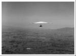
Kaimai, 300 Meter
|
|
| Talort: |
Kaimai, 264 Meter |
| Höhenunterschied: |
36
Meter |
| Streckenflug: |
Ja |
| Seilbahn: |
Nein |
| Windenschlepp: |
Nein |
| Walk and Fly: |
Nein |
|
|
Inland flight site equipped with very good thermic conditions and a lake breeze. The starting place for the Paraglider is above and rather difficult, the wind takes you up very quickly as soon as it captures the paraglider, and hence flying is rather fast also. This is also the case when landing below.
|
|
Schwierigkeit
>> Kaimais is private property and a sensitive site, with access restrictions and locked gates. You MUST approach a keyholder. You cannot independently visit this site. Any poor behaviour or stupid antics on Kaimai will be dealt with by other members on site, or else very shortly after.
Wissenswertes
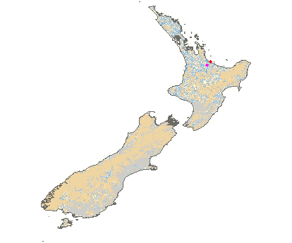
| Anfahrt: |
This site is located 2 hours south of Auckland in the Waikato Area. |
|

 
|
|
 |
|
6 Votes
|
583 Hits
|
| Kaimai |
| //nzhgpa.org.nz/akl.htm |
|
|