Flight zones n° 3 - 8, 3350 Meter


Talort:
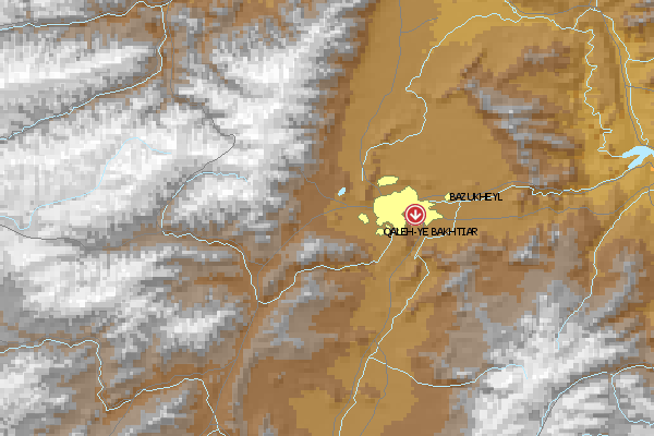
Kabul and around Kabul
Höhe Talort:
1850 Meter
Höhenunterschied:
1500
Meter
Start Richtungen:
Seilbahn:
Nein
Streckenflug:
Ja
Soaring:
Ja
Windenschlepp:
Nein
Walk and Fly:
Ja
Ski and Fly:
Nein
Drachen:
Ja
UL:
Nein
Google Maps:
Qualität Fluggebiet:
Qualität dieser Seite:
Statistik:
Adoption (User):
engelje seit 10.06.2006
Zuletzt bearbeitet:
15.06.2006

|
15.06.2006
|
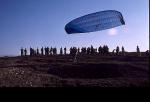
![Paragliding Fluggebiet Asien » Afghanistan,Flight zones n° 3 - 8,This is zone # 4 - we really had good wind this day. When it stopped I had to land on the market in the village below [200 persons around me...].](https://www.paragliding365.com/images/free/flightarea_6085_9424_s.jpg) |
|
6 Votes
|
1933 Hits
|
| [engelje] |
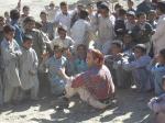
| This is zone # 4 - we really had good wind this day. When it stopped I had to land on the market in the village below [200 persons around me...]. |
|
[Bild hinzufügen]
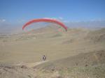
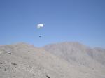
Several hills and mountains around Kabul, where we fly since three years. Most of them reachable by 4x4, the highest one requires 4 hours walking. In case you want to fly here please contact engelje27@yahoo.com
Bewertung der Fluggebiets- und der Seitenqualität
Flug
good soaring possibilities over unspoilt nature [mine fields, nobody tends to go there] and from our highest starting point [+ ~1500 meters] distance flights possible; communication absolutely necessary [for pick-up].
Schwierigkeit
Best time is winter / spring. In summer very heavy thermals and not-flyable dust-devils. In this period only possible in the early morning, late evening.
Start sometimes very complicated [small areas].
Besonderheiten und Webcam
| Glider for start must be protected [we use plastic]. Landing only on agricultural area or tracks, but plenty of place available. |
Walk and Fly
Ausgangspunkt:
Several places but very difficult to find - please contact engelje27@yahoo.com. Mountain tour is possible, requires 4 hours [up to 3.350 meters, but start is possible half way - rest by flying].
Wegbeschreibung:
1. mountain road beside the french post [behind the airport]. flights possible only in direction north [side NOT facing the airport of course]. Mountain road to be taken is 10 KM long, start zones are known and de-mined.
2. for the 1500 meter mountain - marked way, up to a grave field [de-mined, eg, no mines there]. Around 20 KM from Kabul to the south-east.
Sonstiges:
Due to several questions: the salang pass cannot be used for flying [too much wind, too narrow and heavily mined].
Soaring
Soaringbedingungen:
5 places around Kabul can be used for good soaring and are reachable by car [4x4]
Wissenswertes
Seilbahn:
none
Fliegertreff:
engelje27@yahoo.com
Unterkunft:
Gratis - all those who fly with us here [we are currently 5 pilots] are welcome for free.
Anfahrt:
To Kabul are only two ways for the moment - via Dubai or Islamabad.
Sonstiges:
For pictures go to http://www.hotair.de
Download: Google Earth Dateien für Fluggebiet und Flugdaten (IGC, OLC)
Download: Google Earth Dateien (KML-Format), Flugdaten (IGC Format)
Die letzten 3 Flüge
Leider keine OLC Daten vorhanden.
Flugdaten von www.paraglidingforum.com
Leider keine OLC Daten von www.paraglidingforum.com vorhanden.
Umgebungskarte
  Fluggebiet  Flugschule  Aktuelle Position |
Alle Fluggebiete und Flugschulen in der Nähe anzeigen