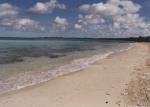
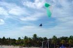
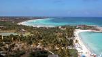
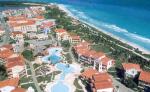
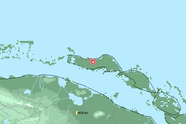
Ciego de Avila, Cayo Coco - La playa, 90 Meter
          
Talort:
Punta La Jaula
Höhe Talort:
2 Meter
Höhenunterschied:
88
Meter
Start Richtungen:
Seilbahn:
Keine Angabe
Streckenflug:
Keine Angabe
Soaring:
Nein
Windenschlepp:
Ja
Walk and Fly:
Nein
Ski and Fly:
Nein
Drachen:
Keine Angabe
UL:
Keine Angabe
Google Maps:
Qualität Fluggebiet:
Qualität dieser Seite:
Statistik:
Adoption (User):
Chris2004 seit 19.10.2005
Zuletzt bearbeitet:
30.12.2005
Paragliding takes place all day from the beach and local men run a boat to the coral reef twice a day for $18. Juan will crack you a coconut for a $1 tip and, for a bit of excitement, you can go snorkelling in the bay next door and watch the fish in just a metre of water.
Bewertung der Fluggebiets- und der Seitenqualität
Download: Google Earth Dateien für Fluggebiet und Flugdaten (IGC, OLC)
Download: Google Earth Dateien (KML-Format), Flugdaten (IGC Format)
Die letzten 3 Flüge
Leider keine OLC Daten vorhanden.
Flugdaten von www.paraglidingforum.com
Leider keine OLC Daten von www.paraglidingforum.com vorhanden.
Umgebungskarte
  Fluggebiet  Flugschule  Aktuelle Position |
Fluggebiete in der Nähe (Radius: 50 km)
Nordamerika » Kuba » Ciego de Avila
Entfernung:
2 km
Höhenuntersch.:
25
Meter
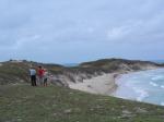
Ort:
Playa Prohibida
Streckenflug:
Nein
Startplatz:
Keine Angabe
Landeplatz:
Keine Angabe
Start Richtungen:

|
02.04.2013
|
 |
|
1 Votes
|
865 Hits
|
| [Chris2004] | | Playa Prohibida |
|
Fantastic site for dune soaring. Incredible moments
Alle Fluggebiete und Flugschulen in der Nähe anzeigen
|