Villa Clara, Loma Vista Hermosa - Primero Enero, 434 Meter


Talort:
Santa Clara
Höhe Talort:
60 Meter
Höhenunterschied:
196
Meter
Start Richtungen:
Seilbahn:
Keine Angabe
Streckenflug:
Ja
Soaring:
Ja
Windenschlepp:
Keine Angabe
Walk and Fly:
Ja
Ski and Fly:
Nein
Drachen:
Keine Angabe
UL:
Keine Angabe
GPS Tal:
Qualität Fluggebiet:
Qualität dieser Seite:
Statistik:
Adoption (User):
Chris2004 seit 07.10.2005
Zuletzt bearbeitet:
22.12.2011
Pictures & Info
Nettes Fliegen, perfekt für Streckengeier. Hier wurden bereits Meisterschaften ausgetragen.
Im Winter zu 90% fliegbare Konditionen, vielleicht das beste Gebiet in dieser Jahreszeit, wegen des Windes.
Bewertung der Fluggebiets- und der Seitenqualität
Flug
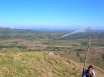
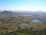
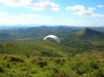
Man erreicht den Startplatz über einen 200m langen Trampelpfad. Die Gegend ist meist recht trocken, sprich thermische Aktivität ist sehr gut. Die Gegend ist für Überlandflüge / Cross Country geeignet.
Schwierigkeit
Takeoff von 45° bis 135°
3 mögliche Startrichtungen:
NO
O
SO
Der Wind steht also quasi immer an!
Walk and Fly
Ausgangspunkt:
Wegbeschreibung:
Sonstiges:
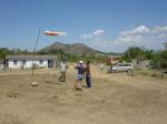
In the 298 Km of the national highway, with NE, E and SE orientations is located this 140 m (to the landing zone) hill. The proximity of the highway and the orientation of the slope makes' it a good place for follow-the-road XC. This site is near the geographic centre of the island that's why the conditions are thermal most of the time. About 30 km NW is Santa Clara city, a good target if you are thinking in XC. TO and landing are straightforward here. A small town of about 30 families is located in front of the hill, a strategic place to eat, stay for a night or only take a bath. This is the
regular place for the Santa Clara Club and 2 local pilots. There is no road to the take of. But once in the top the landscape makes you say "It worth it!"
Wissenswertes
Unterkunft:
Sehr ländliche Gegend. Chichis place hat Zimmer für 10.00 CUC /USD pro Nacht. Vollpension gegen 5 CUC/USD Aufschlag am Tag zubuchbar.
Anfahrt:
Am KM 298 der Nationalstraße A-1, ca. 30km von Santa Clara entfernt. In südlicher Richtung vor der Kreuzung Guaracabulla und Baez.
Sonstiges:
Kontakt:
Club Escaleras al cielo
Andrés Gregorio Caballero González
Calle 3ra # 340 e/ F y G Vigía.
CP 50100 Santa Clara, Villa Clara.
Tel: +53-42-271649
Startplätze
Startplatz:
TakeOff
Startrichtung:

NO O SO Schwierigkeit:
sehr leicht
Höhe über NN:
256
|
Landeplätze
|
Download: Google Earth Dateien für Fluggebiet und Flugdaten (IGC, OLC)
Download: Google Earth Dateien (KML-Format), Flugdaten (IGC Format)
Die letzten 3 Flüge
Leider keine OLC Daten vorhanden.
Flugdaten von www.paraglidingforum.com
Leider keine OLC Daten von www.paraglidingforum.com vorhanden.
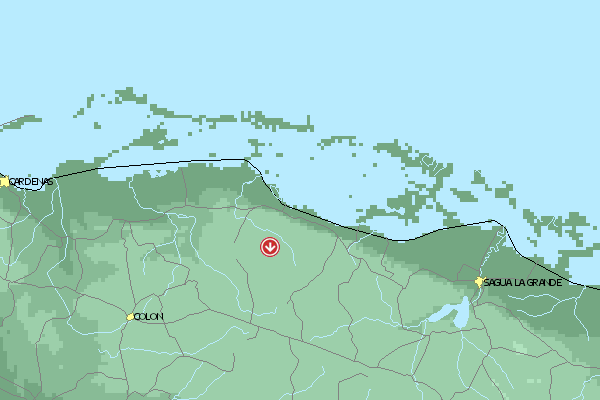
Umgebungskarte
  Fluggebiet  Flugschule  Aktuelle Position |
Alle Fluggebiete und Flugschulen in der Nähe anzeigen