Lookout Mountain, 1950 Meter
          
Talort:
Golden
Höhe Talort:
1680 Meter
Höhenunterschied:
270
Meter
Start Richtungen:
Seilbahn:
Nein
Streckenflug:
Ja
Soaring:
Keine Angabe
Windenschlepp:
Nein
Walk and Fly:
Nein
Ski and Fly:
Nein
Drachen:
Keine Angabe
UL:
Keine Angabe
GPS Berg:
Qualität Fluggebiet:
Qualität dieser Seite:
Statistik:
Adoption (User):
-
Zuletzt bearbeitet:
20.02.2007
The Mt. Zion is possibly the most flown site in Colorado, however also the sensible. It holds you correspondingly at the specification.
Bewertung der Fluggebiets- und der Seitenqualität
Flug
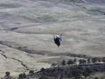
Above all a Thermic-site, soaring and Glass Offs are rare. Both Hang Gliders and Paragliders appreciate the mountain for its cross country potential, nevertheless here were set the Colorado records: 183 and/or 86 miles.
Schwierigkeit
The launch is very small, one should therefore control already capacities for certain Spot landings. USHGA and RMHGA membership required.
Wissenswertes
Anfahrt:
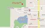
You will find this site half a Mile south of the intersectio of Rt 93 and Rt 6, park and then its 10mins by foot.
Download: Google Earth Dateien für Fluggebiet und Flugdaten (IGC, OLC)
Download: Google Earth Dateien (KML-Format), Flugdaten (IGC Format)
Die letzten 3 Flüge
Leider keine OLC Daten vorhanden.
Flugdaten von www.paraglidingforum.com
Leider keine OLC Daten von www.paraglidingforum.com vorhanden.
Umgebungskarte
  Fluggebiet  Flugschule  Aktuelle Position |
Fluggebiete in der Nähe (Radius: 50 km)
Nordamerika » USA » Colorado
Entfernung:
29 km
Höhenuntersch.:
200
Meter
Ort:
Boulder
Streckenflug:
Nein
Startplatz:
Keine Angabe
Landeplatz:
Keine Angabe
Start Richtungen:
Momentarily only the Coyote, that live in the area in large numbers, howl here: Dakota Ridge is closed. When one can fly again, you will find the cliff in the vicinity of the parking lot Broadway 28thStreet – where it is another 45 minute walk away.
Nordamerika » USA » Colorado
Entfernung:
29 km
Höhenuntersch.:
180
Meter
Ort:
Boulder
Streckenflug:
Nein
Startplatz:
Keine Angabe
Landeplatz:
Keine Angabe
Start Richtungen:

|
17.01.2006
|
 |
|
0 Votes
|
1351 Hits
|
| [Oliver Voss] | | www.parasoftparagliding.com | | So kommt ihr hin. |
|
You can begin the thermic hunt from three launch sites. North Boulder is not difficult and can be flown all year round.
Nordamerika » USA » Colorado
Entfernung:
29 km
Höhenuntersch.:
150
Meter
Ort:
Boulder
Streckenflug:
Nein
Startplatz:
Keine Angabe
Landeplatz:
Keine Angabe
Start Richtungen:
|
|
02.12.2004
|
 |
|
0 Votes
|
604 Hits
|
| www.parasoftparagliding.com |
|
Also the „Beech Aircraft Launch“ named cliff is ideal for Soaring- and Thermic flights. To be sure also here also check the typical Boulder restriction: passing closed. If it changes, park in the Old Stage Road, then 15 min by foot.
Flugschulen in der Nähe (Radius: 50 km)
Nordamerika » USA » Colorado
Fly Colorado
24366 Cody Park Road
Golden, Colorado 80401
Entfernung: 1 km
Karl Decker ist der Leiter dieser Schule, die leider noch keine virtuelle Filiale besitzt.
Nordamerika » USA » Colorado
In seiner über 2000m Höhe gelegenen Schule lehrt euch Mark Windsheimer, die Gravitation zu überlisten...
Nordamerika » USA » Colorado
9325 Perry Street,
Westminister, Colorado 80031
Entfernung: 18 km
Orv Haugen leitet diese Schule durchaus gut, nur in Sachen Website hat er sich noch nicht als Wizard erwiesen.
Alle Fluggebiete und Flugschulen in der Nähe anzeigen
|