Ed Levin, 525 Meter
          
Talort:
Ed Levin
Höhe Talort:
120 Meter
Höhenunterschied:
480
Meter
Start Richtungen:
Seilbahn:
Nein
Streckenflug:
Nein
Soaring:
Ja
Windenschlepp:
Nein
Walk and Fly:
Nein
Ski and Fly:
Nein
Drachen:
Ja
UL:
Keine Angabe
GPS Tal:
GPS Berg:
Qualität Fluggebiet:
Qualität dieser Seite:
Statistik:
Adoption (User):
-
Zuletzt bearbeitet:
15.04.2018
AT Ed Levin in Santa Clara County Park you will find many Beginners and Profis flying at the same time. There are seven varying height levels from the flat practise slope to the highest launch site.
Bewertung der Fluggebiets- und der Seitenqualität
Flug
For all starting sites you will find a large grassy area. Therefore you can start lower and become more familliar with the conditions before you move up higher.
Schwierigkeit
In Summer there can be strong weather conditions and the site can become thermic. Even still it is still possible to fly over the mountain peak. You will find the best soaring conditions before a rain front, however the street is closed in wet weather, meaning alot of Vehicles must stay overnight.
Soaring
Soaringbedingungen:
Best soaring conditions
Ed Levin is usually soarable from the top launches in pre-frontal conditions. Post-frontal generally can't be done because the road to the top is closed when wet. For the same reason, timing your pre-frontal flights can be challenging. More than one pilot has had to leave their vehicle on top until the road was dry enough to pass, sometimes several days. Ed Levin is not generally thermal soarable in the summer due to an omnipresent inversion, but some of the best pilots seem to be able to break through the inversion or get long flights below it. Legend has it that on perfect days, some pilots have launched the 600 foot hill and managed to work their way up the ridges and over the top.
Wissenswertes
Anfahrt:
From 101 heading North or South: About 27 miles South of San Francisco International Airport, at hwy 101 in Sunnyvale, take the Hwy 237 Milpitas /Alviso Exit and head East.
Continue East on 237 about 9 miles to the exit for Calaveras Rd or Blvd. Calaveras Blvd will turn into E. Calaveras Rd. Continue on this east until it starts to wind into the hills. About 1/2 mile up, you will turn left onto Downing Rd. into Ed Levin Park. Just after this, veer right and you will pass the Day Pass station ( you will pay about $5.00 for a day pass here ). Continue into the park, past Sandy Wool Lake and look for the parking lot at the end. Park in the paved parking lot and we meet at the north end of this parking lot.
Sonstiges:
Flight school and further information:
Wings of Rogalla
web site:
http://www.wingsofrogallo.org/sites/ed_levin/index.html
Startplätze
Startplatz:
Ed Levin upper Launch -1750ft
GPS-Koordinaten:
Startrichtung:

S SW W NW Schwierigkeit:
leicht
Höhe über NN:
600
|
Landeplätze
|
Download: Google Earth Dateien für Fluggebiet und Flugdaten (IGC, OLC)
Download: Google Earth Dateien (KML-Format), Flugdaten (IGC Format)
Die letzten 3 Flüge
Leider keine OLC Daten vorhanden.
Flugdaten von www.paraglidingforum.com
Leider keine OLC Daten von www.paraglidingforum.com vorhanden.
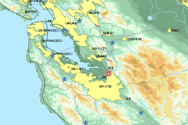
Umgebungskarte
  Fluggebiet  Flugschule  Aktuelle Position |
Fluggebiete in der Nähe (Radius: 50 km)
Nordamerika » USA » Kalifornien
Entfernung:
10 km
Höhenuntersch.:
420
Meter
Ort:
Fremont,Mission Blvd.
Streckenflug:
Ja
Startplatz:
Keine Angabe
Landeplatz:
Keine Angabe
Start Richtungen:
Einfacher Berg mit Soaring und bedingtem Strecken Potential. Startplatz zu Fuß ca 1 Std. oder durch lokale Piloten zu erreichen mit 4x4. Schöner Abendflugberg mit tollem Ausblick über die Bay Area.
Sehr beliebt bei Fliegern mit „Advanced“ Rating (P4) und ein wahrlich historischer...
Nordamerika » USA » Kalifornien
Entfernung:
40 km
Höhenuntersch.:
780
bis
900
Meter
Ort:
Mount Diablo
Streckenflug:
Nein
Startplatz:
leicht
Landeplatz:
leicht
Start Richtungen:
Das Gebiet mit dem teuflischen Namen ist eine anspruchsvolle aber auch extrem vielseitige Mountain-Site in der Bay Area.
Flugschulen in der Nähe (Radius: 50 km)
Nordamerika » USA » Kalifornien
Die Mission von Pat Denevan begann 1973. Seit dem ist er aktives Mitglied der 'Northern Hangglide Community'. Geschult wird mit bestem Material in...
Nordamerika » USA » Kalifornien
Die Wings sind schon seit Mitte der 70er in den Lüften der Bay Area. Sie betreuen Seiten wie den beliebten Ed Levin Park oder Mt. Diablo.
Nordamerika » USA » Kalifornien
Fly Aeros
Steve Daleo
5130 Foothill Road
Pleasanton, California 94588
Entfernung: 26 km
FlyAeros hat die US-Distribution für Aeros-Glider und anderes Fluggerät übernommen. Das Headquarter ist zwar in der Ukraine doch in den USA gibt...
Alle Fluggebiete und Flugschulen in der Nähe anzeigen
|